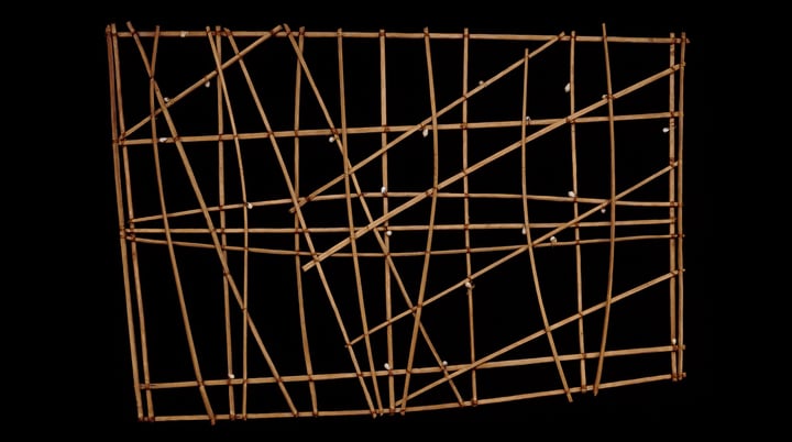
Micronesians Navigated the Pacific by Using the Stars, Recognizing and Interpreting Different Types of Ocean Swells. They Also Make Stick Maps of These Ocean Swell Patterns.
The Micronesians or Marshallese were able to build vessels known as outrigger canoes and develop their system of piloting and navigation centuries ago. Long before modern mapping and GPS, the Micronesian people relied on their ability to sense the motion of the waves for navigation. But did you know that they also navigated ocean swells? […]