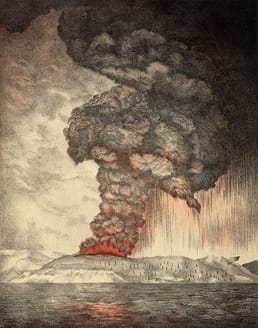
Coastal Alaska has the highest tsunami risk in the United States. Tsunamis caused by earthquakes in Alaska have historically caused damage and loss of life along the West Coast and across the Pacific. On the other hand, tsunamis generated by nearby earthquakes are considered near-field hazards in Alaska. But do you know when the Mega Tsunami in Alaska happened?
In 2015, Alaska was hit by a megatsunami, the fourth largest on the planet.
The 4th Largest Megatsunami
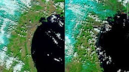
On October 17, 2015, 180 million tons of rock slid into Taan Fiord, an arm of Icy Bay, causing a tsunami that striped forest from 8 square miles or 20 square kilometers of Wrangell St. Elias National Park and Preserve and reached 633 feet or 193 meters above the fjord, the fourth-highest tsunami ever recorded. It had almost no human impacts, no one was injured, and the only damage to infrastructure was rocks scattered on a beach used for landing bush planes, a stroke of luck that may not be repeated in the future.
Although no one saw the slide or tsunami, automatic seismic systems identified it within hours using Ekström and Stark’s 2013 methods. The general location and direction of the landslide were determined by the inversion of long-period waves arriving at nearby seismometers.
The slide’s impact on the water created one of history’s tallest tsunami waves. The wave reached 633 feet or 193 meters above sea level. The wave stripped vegetation to varying heights as it moved down the fjord, gradually diminishing down-fjord.
The wave reached 50 feet or 15 meters at the mouth of the fjord, 10 miles or 16 kilometers from the landslide, and dragged icebergs through moraine hills. The wave reached 36 feet or 11 meters and toppled trees two and a half miles or 4 kilometers away, on a section of the west coast of Icy Bay that faces directly toward the mouth of Taan Fiord, but quickly diminished to below high tide as it spread out along the coast. The tsunami’s faint echo reached tide gages 80 and 250 miles which is 130 and 400 kilometers respectively, where it caused 40-minute oscillations of several inches in water level. (Source: National Park Services)
Taan Fiord Warning
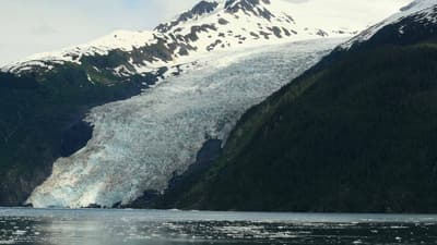
The Taan Fiord event warns that similar, potentially more deadly events may occur in Icy Bay in the future. Over three centuries, Lituya Bay produced at least five massive tsunamis and Icy Bay could easily break that record.
Icy Bay was covered in glaciers a century ago. It wasn’t until the 1960s that four steep-walled fjords opened up at the bay’s head. The 2015 tsunami was the largest to occur in this short period, but it was most likely not the only one.
Though logging along its shore has ended, plans for a large-scale mine are being considered, which could create another vulnerable facility. When the tsunami struck in October 2015, workers were present in Icy Bay Lodge, only 20 miles or 32 kilometers away and beyond the damaging waves. However, many similar situations could have had a more significant impact:
- A landslide during a busy season
- A small landslide or tsunami affecting a beach campsite
- A large landslide occurred in one of Icy Bay’s other fjord arms
Because of the bay’s geometry, a tsunami in a different arm would directly impact the outer part of Icy Bay, where there is more human activity. (Source: National Park Services)
Image from Firstpost