
At a National Geodetic Survey webinar in November 2022, a participant objected to the government's plan to retire a unit of measurement. Many surveyors used the U.S. survey foot, the participant pointed out. Why ask them to switch to a different foot when they were already working with this one?[3]
A foot could mean two slightly different lengths, depending on who was doing the measuring. The international foot was exactly 0.3048 meter. The U.S. survey foot was a little longer. Most people could go about their lives without knowing that, but someone handling survey coordinates had to be sure which version the numbers meant.[1][2]
In the exchange reproduced by Wisconsin's State Cartographer's Office, the National Geodetic Survey answered the objection by asking people to consider everyone else who measured in feet. Surveying accounted for only a small share of that activity, and the international foot had already been the country's general standard since 1959.[3]
The Temporary Exception That Lasted for Decades
When the United States adopted that standard, it gave geodetic surveying, the work of establishing positions over large areas, permission to keep the older definition temporarily. Surveyors had been using a foot defined as exactly 1200/3937 of a meter since 1893. The new name, U.S. survey foot, let them distinguish it from its replacement while the country prepared to readjust its survey networks.[1]
When the networks changed in 1986, surveyors continued using the older unit despite the original plan to withdraw it. By the time the webinar participant questioned its retirement in 2022, people had spent decades working with an exception that was meant to end.[1][3]
Across a mile, the two definitions differ by only about a hundredth of a foot, which helps explain why the distinction can seem fussy. Survey coordinates make the problem easier to see. NIST gives the example of a coordinate of one million feet: interpret that number using the other definition and the discrepancy is about two feet. Even a small worksite can have large coordinate values.[2]
Instruments and software sometimes defaulted to one version while their users assumed the other, according to NIST. The mistakes had caused boundary disputes and project delays. Some jurisdictions even used different feet for horizontal coordinates and elevations. A person could need both definitions in the same job.[2]
Retiring the Foot Without Losing the Old Work
On January 1, 2023, the longer survey foot officially became obsolete, with historical and legacy applications excepted. The exception left room for all the measurements people had already made. Simply treating old coordinates as international feet would create another unit mismatch.[1][2]
Writing just before the retirement, Wisconsin state cartographer Howard Veregin warned against switching units in older coordinate systems that used the survey foot. NIST likewise explained that some projects could sensibly remain in their existing systems. Retiring the unit still meant preserving a way to read the work of people who had used it.[2][3]
For anyone opening those old files, NIST stressed the importance of keeping documentation with the measurements. The word "feet" beside a set of coordinates could leave the next person with a question. A note identifying the particular foot would give them the answer.[2]
Sources
- NIST: U.S. Survey Foot
- NIST: U.S. Survey Foot Questions and Answers
- Howard Veregin, Wisconsin State Cartographer: A Final Farewell to the US Survey Foot?
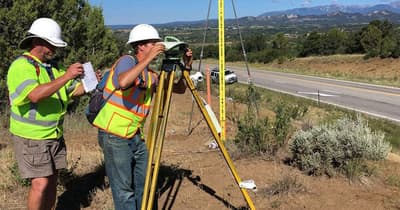
Image: NOAA National Geodetic Survey. Charles Geoghegan and Benjamin Erickson surveying in Colorado, summer 2017. Contextual fieldwork photograph, cropped. Original photograph and caption.